Ardmore Point offer nationwide, professional land and geospatial survey solutions.
Combining our technical expertise with the latest equipment we serve a broad base of clients including developers, architects, consulting engineers, project managers, contractors, landscape architects,& government sector clients.a
Services offered:
- Land & Geospatial Surveys
- Measured Building Surveys
- 3D Laser Scanning
- Underground Utility Scanning
- Setting Out & Site Engineering
- Structural Monitoring
Working throughout the UK with cutting edge technology, professionally trained & experienced staff are deployed to capture survey data to provide efficient accurate surveys for clients, consultants and design teams.
Land surveying is the technique, profession & science of determining the terrestrial or 3 dimensional position of points and the distances and angles between them.
Topographical Surveys
Our most requested Topographic Survey instructions come from clients requiring a layout or base plan of their land prior to development. It’s worth noting that we are able to supply all of our surveys in BIM compatible software formats for the crucial first layer of building design.
As well as Total Station techniques we are highly experienced with using GPS equipment mean that it has now become a standard format in surveying due to its speed and effectiveness. Using GPS ensures highly accurate data capture along with the ability to cover large tracts of open land quickly.

Topographical Surveys are normally instructed for:
- Surveys for housing development plans
- Streetscape/ landscape design
- River section surveys and flood risk surveys
- Highway infrastructure
- Railway infrastructure
- Golf course construction
- Site surveys for commercial / residential planning applications
- Measured Building Surveys
Our clients request measured building surveys for a variety of end uses, including:
- Base model plans for planning, design and BIM modelling
- Floor Plans / Elevations / Sections
- 2D/3D/BIM/Revit
How we carry out our measured building surveys depends upon our client’s end requirements. Streetscapes and architectural definition are more often than not defined within line drawings using a total station to capture the data. More complex, photogrammetric end requirements mean that our 3D laser scanner is more suitable. Our surveying teams are fully equipped to capture all data required.
Text BoxDue to their very nature external elevations are one of the most visually stimulating data we provide and can be sent in a variety of digital formats to the client’s requirements.
3D Laser Scanning
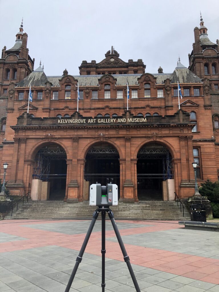
Due to advances in technology, we can scan a site and collect a vast amount of spatial data at 1 million measured points per second, delivering it in HDR imaging up to a range of 270m. Our laser scanner picks up millions of points in any one area at speed giving a photographic quality to the plans which can be used for anything from panoramic walk-throughs to the final as-constructed layouts of a building.
3D Laser Scanning can be effectively utilised for a wide range of projects including:

- 3D Building Models for integration into BIM / Revit
- Archaeological sites and heritage surveys
- Topographical surveys
- Civil infrastructure surveys
- Detailed elevation surveys
It is possible to use 3D Laser Scanning before a project commences to assist with on-site logistics and allow designers to gain valuable data regarding information such as adjacent building heights or obtain vital dimensions for planning purposes.
Underground Utility Scanning
Utility Detection Surveys are essential on any design and construction project as a way of communicating the constraints of the underground services environment, ensuring the health and safety of contractors and the public, minimising utility damage, reducing CDM costs and keeping the project on track and within budget.

By understanding what is underground, designers and developers are then equipped with the data to make informed decisions regarding the position of new utilities and what to do with the existing, possibly densely packed, cabling and pipes, especially in brown and green field sites.
We create our utility plans by pulling together all available disciplines and technologies to produce as near a complete underground picture of a site as possible.
- Collation and on site analysis of statutory record / guide drawings
- Deployment of electromagnetic devices to locate and map metallic buried services
- To locate and map accessible sewers and ducts
- Deploying Ground Probing Radar to establish position and depth of non-metallic, fibre optic and plastic buried services
- Production of a topographical base plan with services overlaid in colour
- Setting Out / Site Engineering
A key element of the construction process is absolute accuracy when setting out buildings or infrastructure. Our experienced and dedicated land surveyors ensure that all setting out is implemented with accuracy and efficiency using a combination of Leica robotic total stations and GPS equipment.
Using the total station with the uploaded coordinates, our land surveyors can easily set up a network of control stations and reference objects in order to set out the points required on site.

Examples of some of our setting out projects include:
- Residential developments
- Piling / foundations
- Roads and highway infrastructure.
- Text BoxDrainage schemes.
- Complex steel infrastructures.
- Geotechnical investigations for large scale projects – motorways, pipelines etc
Structural Monitoring
Buildings can be subject to movement such as land settlement or subsidence resulting in the need regular monitoring surveys:
- Subsidence Survey
- Precise Levelling Survey
- Settlement Survey
- Façade Monitoring
Surveys of this type are often used to monitor anything from residential properties through to bridge construction. A monitoring survey ensures that these permanent points are accurately surveyed over an agreed period of time.
To do this, we survey the permanent monitoring points using reflector-less instruments taking measurements on a suitable grid to allow us to compare data from previous visits. Over time, data is collected and can be presented in a variety of formats to show the level of movement that has occurred.
